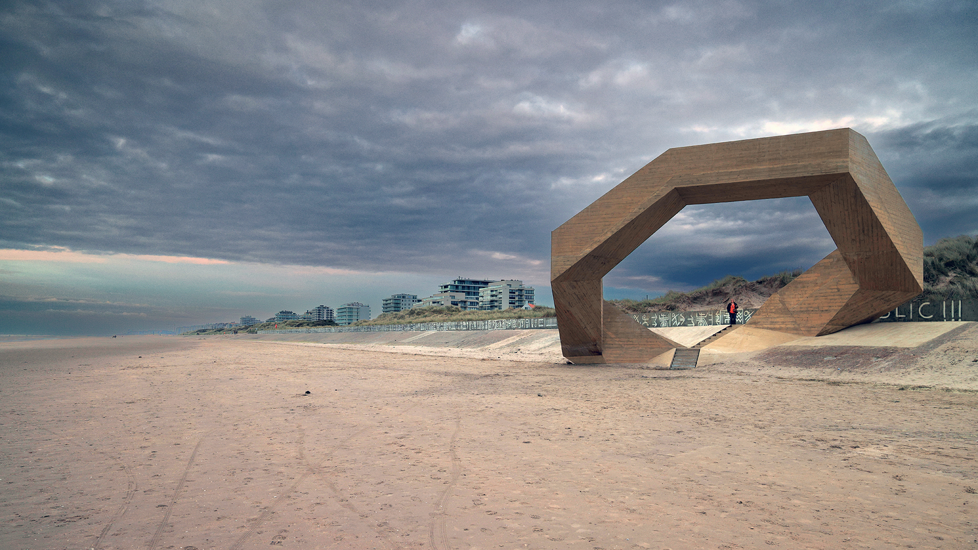
Westerpunt (De Panne, Belgium)
Photos - Info - Meteo - Tips - Nieuws - Geo Info -
General information about Westerpunt
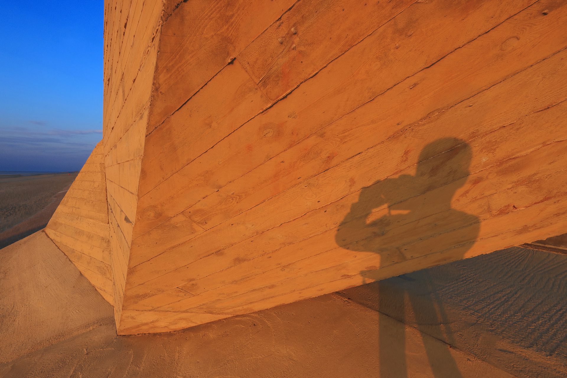
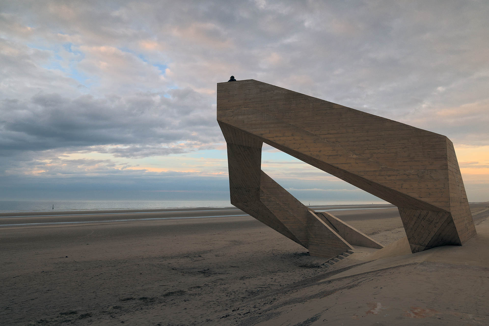
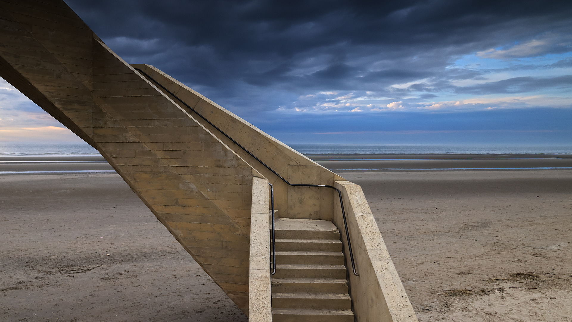
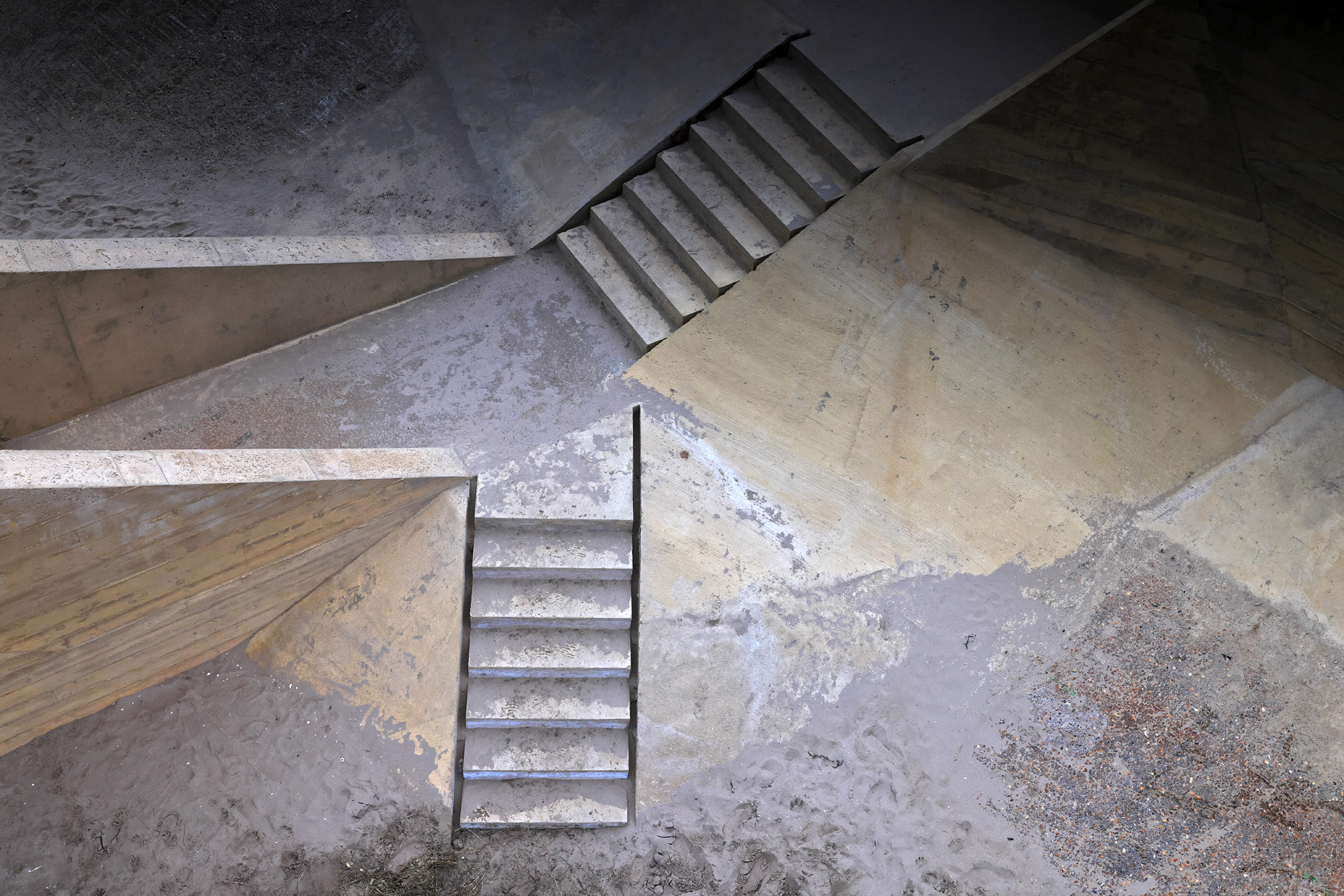
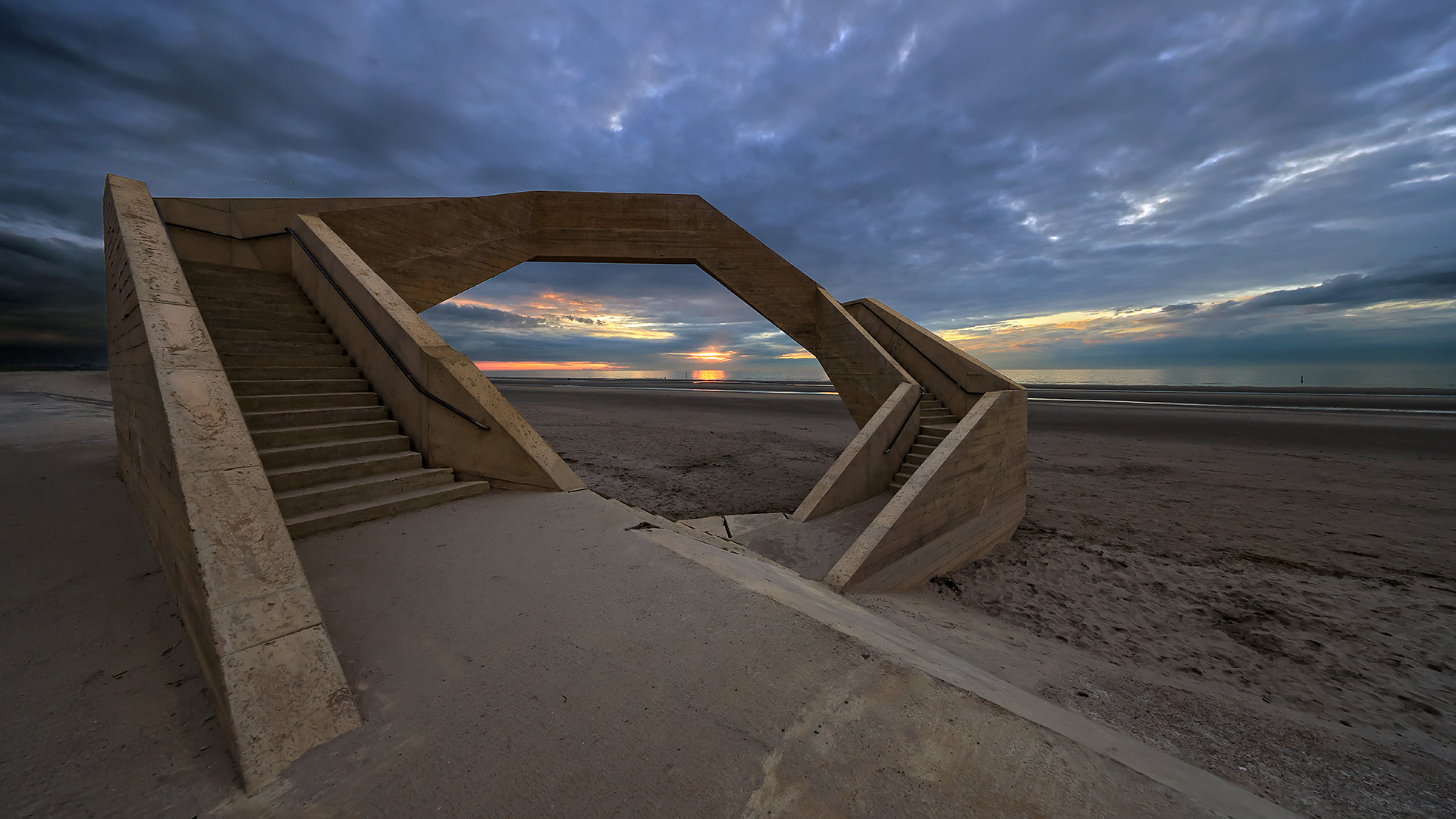
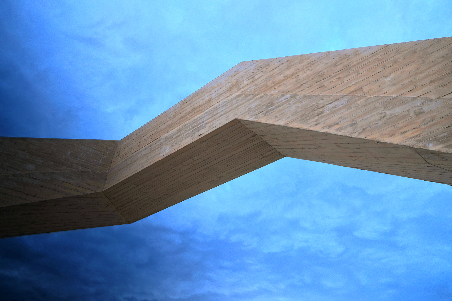
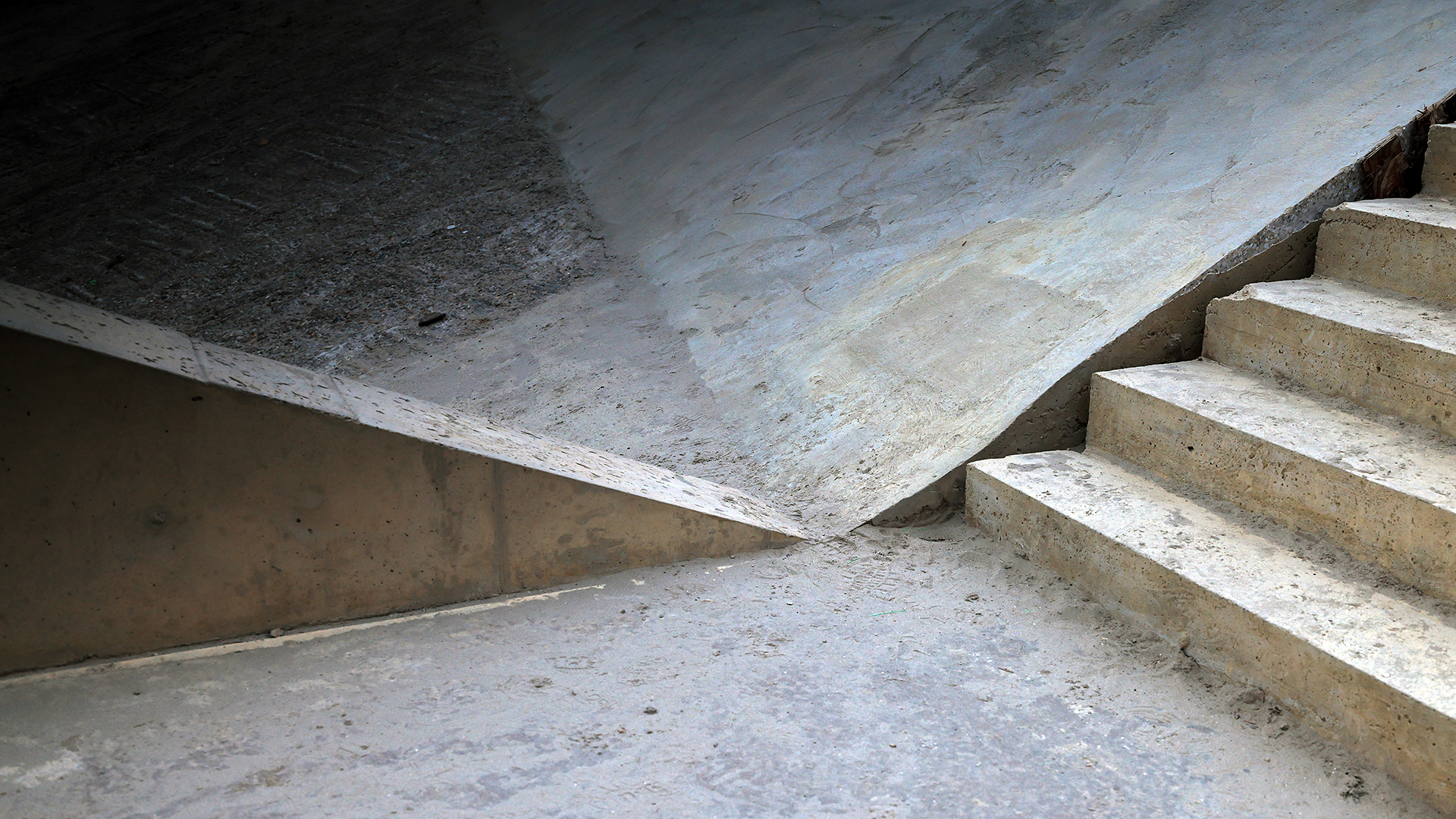
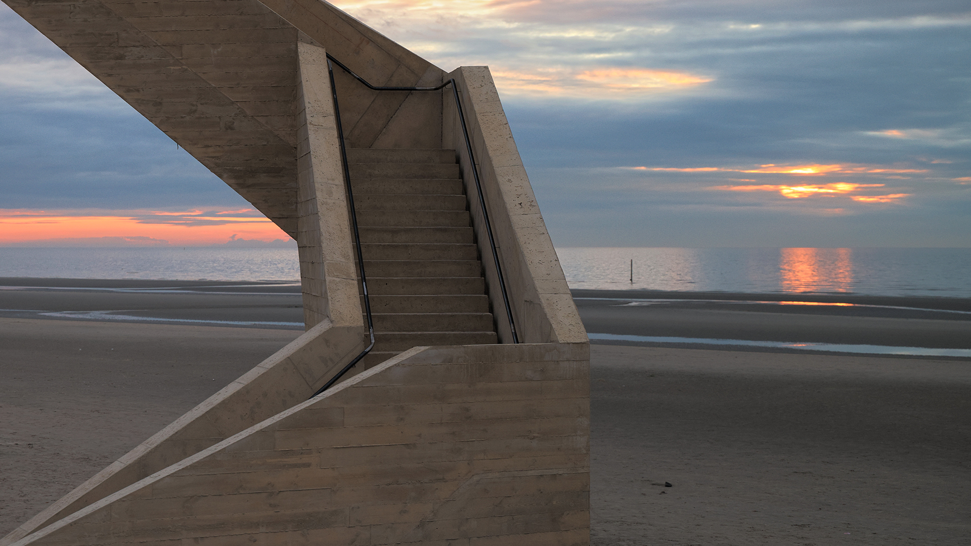
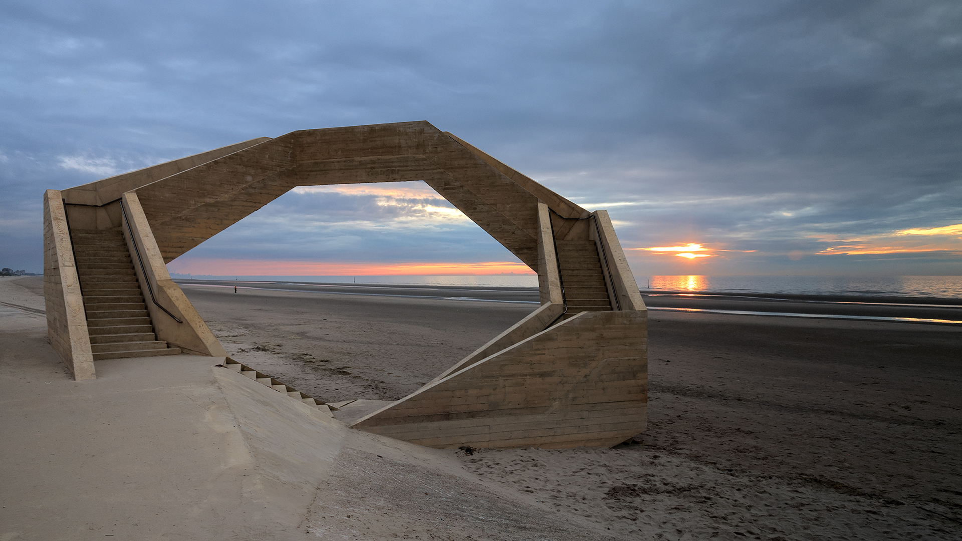
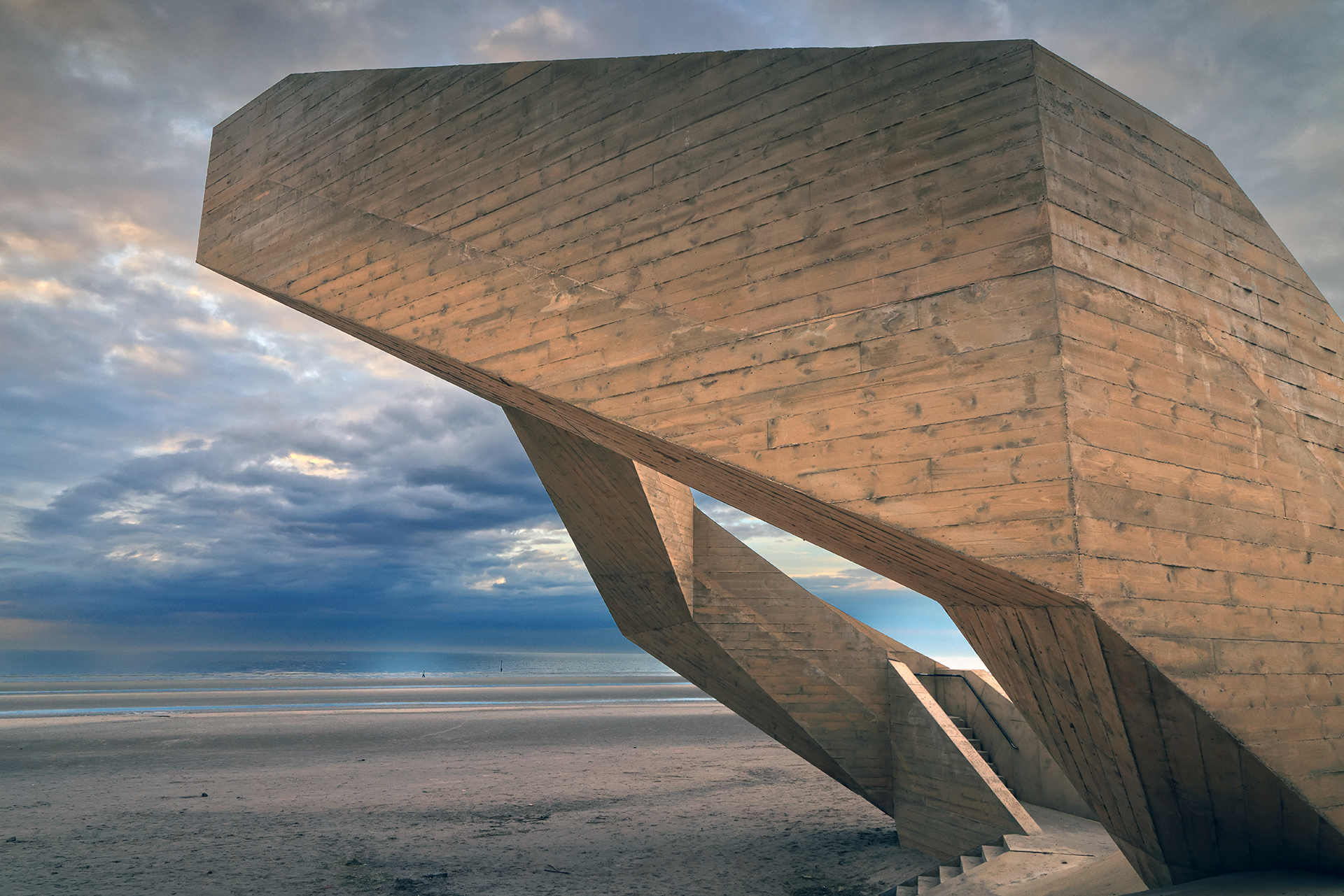
On Friday, May 3, 2024, viewpoint "Westerpunt" was solemnly declared open. It is part of the Horizon 2025 project of Westtoer, the autonomous public company of the Province of West Flanders which is responsible for the tourist promotion of the province in general and the coast in particular. This geometric, lazy staircase with a height of 6 meters allows the beach visitor to have a panoramic view over the Nature Reserve "De Westhoek" and the North Sea. In the distance, you can also see the skyline of the port of Dunkirk.
This 9-meter-high creation in pigmented concrete was financed 50% by Westtoer and 50% by the municipality. A budget of about 1 M€ was provided. The design comes from architect Mo Vandenberghe of Studio MOTO (in collaboration with Mouton Engineering). The execution was in the hands of Furnibo.
On the Mouton Engineering website, we read further: "The project is part of WinVorm, a platform for innovative interventions in public space, and is twofold. On the border of the Houtsaeger Dunes, a little further on, a rest and information point will be built. Both designs are connected by their materialization and design."
On September 10, 2025, the "Westerpunt" was proclaimed by the readers of the "Krant van West-Vlaanderen" and "Visit West-Vlaanderen" as the "most beautiful spot in West Flanders". There were no less than 196 spots that aspired to this label.
In 2025, De Panne organized a photo contest. Some 300 photos were submitted. Some 50 were selected and are currently still on display at the cultural center De Scharbiellie.
Did you know... the West Point is actually not the West Point?
The fact is: every country has a South Point, North Point, ... and indeed a West Point somewhere. So this should be the westernmost point in Belgium. However, this is not the case: The monument "Westerpunt" is located at 2.561 743° East longitude. The real Westerpunt of Belgium is still about 1.3 kilometers away from that: at the French border. Its geographical longitude is 2.545 403° East longitude. That one is significantly more to the West. And so the "Western Point" is not the Western Point of Belgium. 'Tis just a know ... for gnat sifters 😉.
We could even go a step further: as M Van Broeck noted: if you take the Involves territorial waters of Belgium, 't yes, then you could even move a little-piece more to the West. However, you don't normally do that when defining a West Point. One limits oneself to solid ground. Even an island is OK. Just think how northerly the "North Cape" in Norway would be? Unless you wanted to distinguish between "North Point" and "North Cape." And so we can keep busy... 😉
Newsletters
Visitor tips
Algemene tips:
1) zoekt U naar andere bezienswaardigheden in de buurt, raadpleeg dan onze Toeristische kaart van Top.Vlaanderen.
2) U kan onze overzichtslijsten raadplegen: per categorie ( bijv. tijdslijn, grootte, …) of per regio
3) U kan ook altijd de lokale toeristische diensten raadplegen :
De Panne, West-Vlaanderen, Vlaanderen, België: | ||||
| About Us | ||||
| Parent tourist regions: | ||||
| About Us | ||||
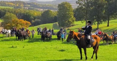
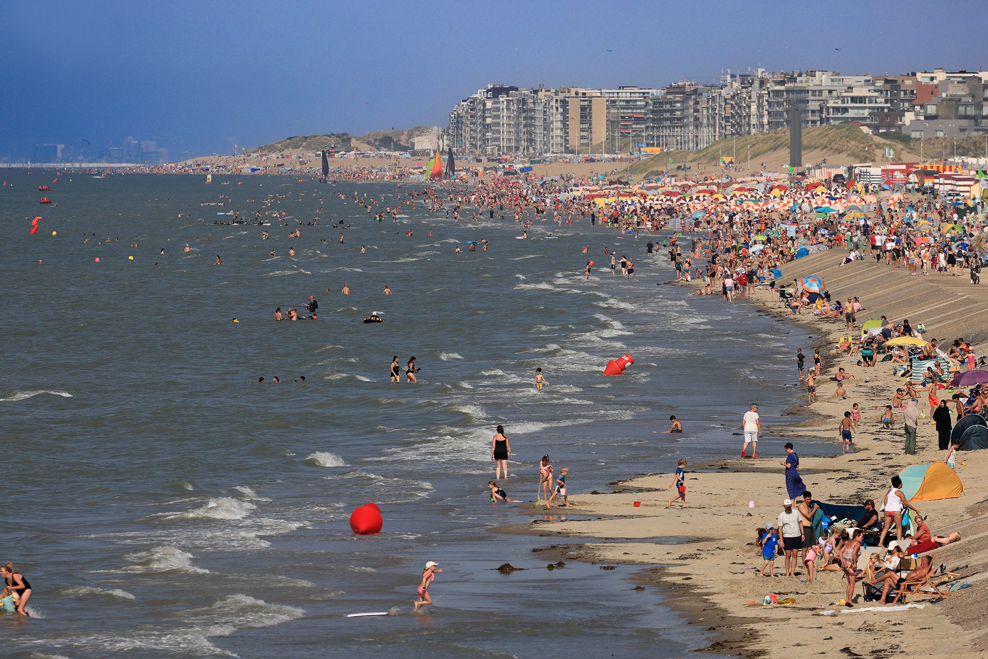
Tip 1: Bring binoculars or a strong telephoto lens: you can then zoom in on ships on the North Sea, the port of Dunkirk or the beaches of de Panne, Saint-Idesbald, and so on. The pictures below illustrate what we mean.
Tip 2: By the sea, there can be quite a bit of wind. Prepare for that if necessary.
Tip 3: Westerpunt is particularly beautiful and comes into its own when the tide is out. At high tide, you are above the sea. Consult the tide forecast below to know when it will be high tide.
Tip 4: The sea can be very beautiful but also very treacherous. Check the weather forecast below. If there is a storm warning, don't take unnecessary risks! The graveyards are full of people who thought nothing bad could ever happen to them. A person warned is worth two.
Geographical information
Address: Slufterpad, 8660 De Panne, West Flanders, Flanders, Belgium
Geographic coordinates:
– Google Maps: Latitude = 51.0945591 – Longitude = 2.5591871
– OpenStreetMap: Latitude = 51.094634 – Longitude = 2.561798
– Altitude h = 1 m
Location of Westerpunt on:
Tourist map from Top.Vlaanderen – Google Maps – OpenStreetMap.
Route to Westerpunt: Route via Google Maps
Meteo

| Day | Condition | Temperature | Precipitation | Rain Chance | Wind | Humidity | Pressure |
|---|---|---|---|---|---|---|---|
|
Today
9:00 p.m.
|
|
15° | 25°°C | 1 mm | 100% | 16 Km/h | 88 % | 1021 mb |
|
Tomorrow
9:00 p.m.
|
|
12° | 19°°C | 0.99 mm | 99% | 28 Km/h | 94 % | 1018 mb |
|
Sun, May 26
9:00 PM
|
|
11° | 21°°C | 0 mm | 0% | 16 Km/h | 98 % | 1018 mb |
|
ma jun 26
21:00
|
|
12° | 18°°C | 1 mm | 100% | 23 Km/h | 96 % | 1011 mb |
|
di jun 26
21:00
|
|
14° | 19°°C | 1 mm | 100% | 28 Km/h | 95 % | 1011 mb |
| Hour | Condition | Temperature | Precipitation | Rain Chance | Wind | Humidity | Pressure |
|---|---|---|---|---|---|---|---|
|
Today
3:00 a.m.
|
|
15° | 17°°C | 0.84 mm | 84% | 4 Km/h | 86 % | 1021 mb |
|
Today
6:00 a.m.
|
|
17° | 17°°C | 0.9 mm | 90% | 4 Km/h | 86 % | 1021 mb |
|
Today
9:00 a.m.
|
|
21° | 22°°C | 1 mm | 100% | 7 Km/h | 75 % | 1021 mb |
|
Today
12:00
|
|
25° | 25°°C | 0.88 mm | 88% | 5 Km/h | 58 % | 1019 mb |
|
Today
3:00 p.m.
|
|
25° | 25°°C | 0 mm | 0% | 9 Km/h | 57 % | 1018 mb |
|
Today
6:00 p.m.
|
|
20° | 20°°C | 0 mm | 0% | 16 Km/h | 73 % | 1016 mb |
|
Today
9:00 p.m.
|
|
16° | 16°°C | 1 mm | 100% | 8 Km/h | 88 % | 1016 mb |
|
Tomorrow
12:00 AM
|
|
15° | 15°°C | 0.99 mm | 99% | 8 Km/h | 92 % | 1016 mb |
Tide predictions
Want to see the tides for another date?
Online information about Westerpunt
Visitor numbers: 23,000 per month on average, between May 2024 and September 2025: 300,000
Internet media;
Website - Wikipedia (EN)
Official web site about the Horizon2025 project Westtoer.
The West Point project on the official web site of Studio Moto.
The West Point project on the official web site of Mouton Engineering.
Tourism Department "Visit De Panne"
Website - Facebook - Instagram - ![]() YouTube
YouTube
Tourism "The Coast (Westtoer)
Website - Facebook - Instagram - ![]() YouTube
YouTube
Our photos about Westerpunt
Our photos, videos, etc. are all (c) 2004-2026, Top.Vlaanderen, Belgium. They may not be copied or used without permission. If you would like to use them for a project, please contact us in advance and we will see how we can work together. If you would like us to photograph your own tourist attraction, B&B, vacation home, etc., that is also possible. Please contact us via our contact form .
Photos taken on a bright summer day, during high season and at high tide (Aug. 14, 2025)
These photos were taken with a Canon EOS R5 45 megapixel camera with 500 mm telephoto lens.


Photos from July 2, 2025 at sunset:


Photos at twilight and starry skies (Oct. 11, 2024):


Photos from June 2, 2024 at sunset and retreating sea:

Photos from May 5, 2024 at sunset:
Photos from July 29, 2023:
Disclaimer: All information presented on top.vlaanderen has been compiled with the utmost care. It is also checked regularly. If you have any comments, errors, additional information, etc... please contact us via our contact form. We are not responsible for possible incorrect or incomplete information.