Kattesas – Onderwaterzetting IJzervlakte (Nieuwpoort, België)
Foto’s – Info – Meteo – Tips – Nieuws – Geo Info –
Algemene info over Kattesas - Onderwaterzetting IJzervlakte
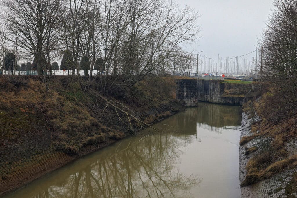
Dit rubriek gaat over het Kattesas en de Onderwaterzetting van de IJzervlakte. Het Kattesas werd ook de “Spaanse sluis” genoemd omdat het waterbouwkundig werk dateerde uit, of werd versterkt tijdens, de periode van de Spaanse overheersing van de Zuidelijke Nederlanden in de 16e en 17e eeuw. Soms zie je ook nog de vermelding “Oud Veurnesas“. Het is via deze kleine overlaat (ze heeft een breedte van amper 5,6 meter) dat men in de eerste wereldoorlog probeerde de IJzervlakte onder water te zetten.
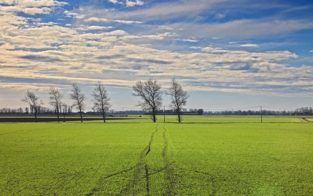
Na dit 2x geprobeerd te hebben via het Kattesas (en men constateerde dat aldaar het debiet té klein was) besloot men uiteindelijk toch om ook de grote sluizen aan het sluizencomplex van “de Ganzenpoot” gericht open te zetten, meer bepaald de Overlaat van de Noordvaart (Veurne-Ambacht). Het was Karel Cogge, een opzichter van de Noordwatering Veurne (NWV), die met dit idee afgekomen is. De militaire overheid probeerde het eerst vanwege veiligheidsoverwegingen via het Kattesas maar diende uiteindelijk toch Cogge’s plan uit te voeren. Zo kwam dan op 29 oktober 1914 de vlakte tussen de IJzer enerzijds en de spoorlijn Nieuwpoort-Diksmuide anderzijds volledig blank te liggen. We spreken hier over een strook van zo’n 1 tot 3 km breed en 15 km lang, grofweg zo’n 30 km² dus. Het water stond er 30 à 60 cm hoog. Hierdoor kon de Duitse invaller niet verder oprukken. Gedurende heel Wereldoorlog I werd standgehouden aan de lijn Nieuwpoort-Diksmuide, mede dank zij dit ingenieus plan van de onderwaterzetting.
Aan het sluizencomplex “Ganzenpoot“, meer bepaald tussen de Veurnesluis en de Overlaat van de Noordvaart, zie je nog een monument dat herinnert aan deze historische gebeurtenis.

Karel Cogge was opzichter van de waterhuishouding/Noordwatering in Veurne. Zijn standbeeld staat aan de Sint-Walburgakerk te Veurne (foto’s hier onder in de fotosectie).
Hij zette uiteraard niet alle sluizen zelf open. De Belgische genietroepen deden dit onder leiding van reservekapitein Robert Thys. Deze militair verbleef in de Dumontwijk te De Panne (in Villa “Val d’Ante”, nu Villa “Zonneweelde” geheten). Enkele helden van zijn compagnie nl. Nieuwpoortse schippersknecht Hendrik Geeraert, Frans Cop en Kamiel Van Belle werden ingekwartierd in de villa er vlak naast nl. Villa “La Roche”. Zowel Cogge als Geeraert worden heden ten dage nog steeds als helden aanzien, de ene in Veurne, de andere in Nieuwpoort. 😉
Chronologisch verloop:
– 21 oktober 1914: Hendrik Geeraert zet bij nacht en hoogtij het Sas van de Kreek van Nieuwendamme open
– 26 oktober 1914, 2h 30: Kattesas wordt geopend (“Plan B” van Cogge), om 3h 45 vallen de sluisdeuren onverwachts dicht! Men koos voor het Kattesas omdat de sluizen van de Ganzenpoot in het berik van de Duitse artillerie lagen.
– 27 oktober 1914: tweede poging via het Kattesas (sluisdeuren werden met kettingen geforceerd open gehouden)
– 28 oktober 1914: Kattesas wordt verder gebruikt (2x per dag – bij hoogwater). De Ijzervlakte vult zich echter niet snel genoeg met water.
– 29 oktober 1914: Hendrik Geeraert opent uiteindelijk dan toch de sluizen van Veurne-Ambacht (sluizencomplex De Ganzenpoot) – dit was “Plan A” van Cogge. Volgens sommige bronnen zou dit alternatieve plan echter van Geeraert zijn gekomen. 😉 Maar goed, de IJzervlakte stroomde nu sneller vol.
– 30 oktober 1914: de IJzervlakte is al zo’n 4 à 5 km landinwaarts volgelopen
– 1 november 1914: de IJzervlakte is volgelopen.
De beslissingen over welke sluis mocht worden opgemaakt werden steeds door de militaire overheid genomen. Was Cogge eerder de bedenker van het plan, Geeraert was de uitvoerder (eigenlijk één van de uitvoerders).
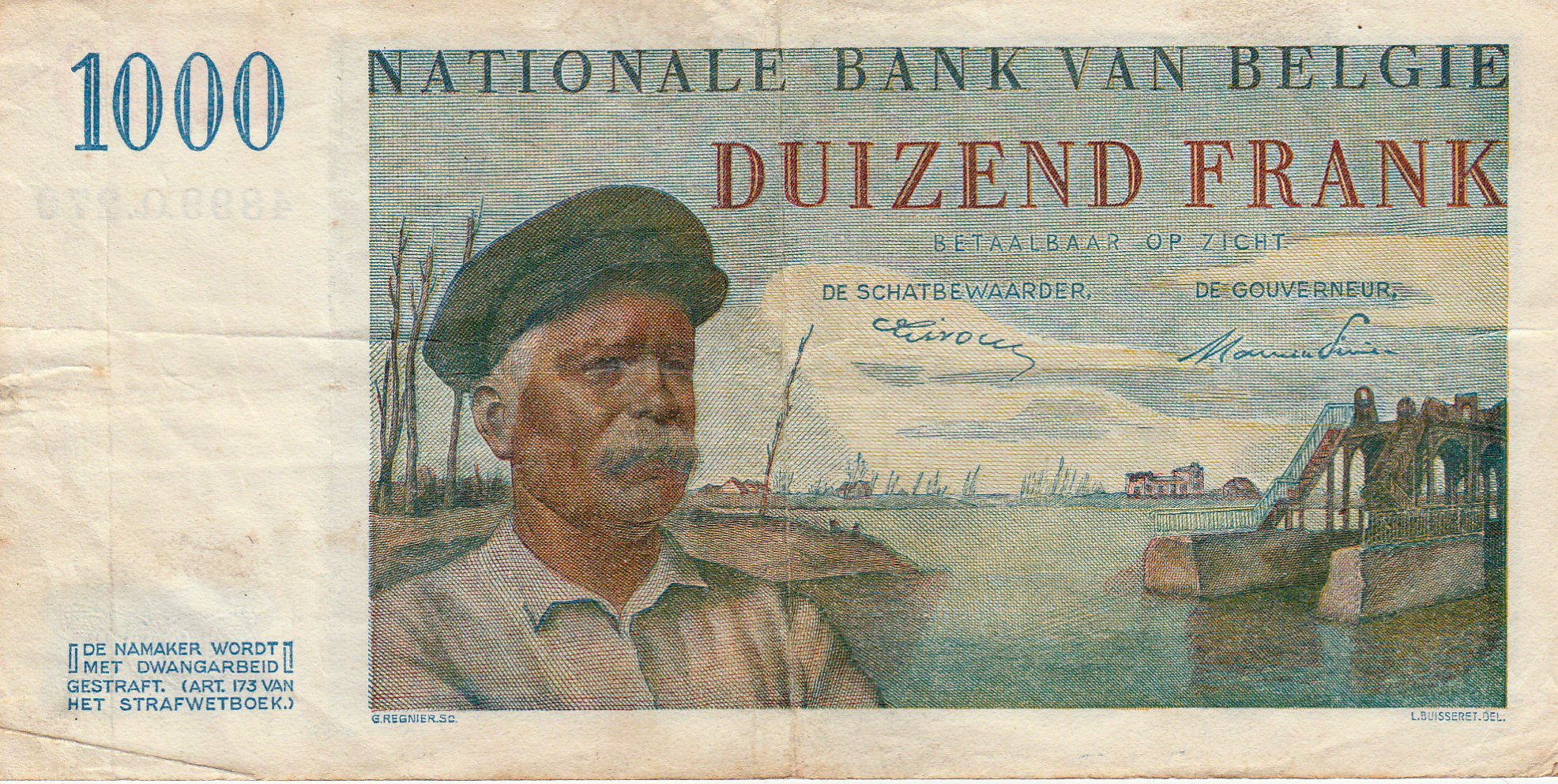
Als erkenning voor diens inzet werd Hendrik Geeraert na de oorlog afgebeeld op de biljetten van 1.000 BEF.
Wist je dat… de techniek om door onderwaterzetting de vijand op afstand te houden eigenlijk helemaal niet kwam van Karel Cogge (noch van Hendrik Geeraert)? Het onder water zetten van stukken land is namelijk een eeuwenoude, beproefde militaire tactiek om de vijand te hinderen in haar opmars. Er zijn voorbeelden die al enkele eeuwen terug gaan: denk maar aan de Oude Hollandse Waterlinie (17e eeuw). Die werd ingezet tegen o.a. Frankrijk (Rampjaar 1672). Grote delen van Holland werden toen bewust geïnundeerd. Men regelde toen de waterstand tot op enkele centimeters nauwkeurig. Ook tijdens de Tachtigjarige Oorlog staken de Nederlanders de dijken door om grote stukken land onder water te zetten. “Onderwaterzetting” als tactiek om de vijand op afstand te houden kwam dus zeker niet van Karel Cogge. Dat is een misvatting bij de algemene bevolking. Hij had wel de lokale kennis om de IJzervlakte goed en snel onder water te krijgen.
Nieuwsbrieven
Bezoekerstips
Algemene tips:
1) zoekt U naar andere bezienswaardigheden in de buurt, raadpleeg dan onze Toeristische kaart van Top.Vlaanderen.
2) U kan onze overzichtslijsten raadplegen: per categorie ( bijv. tijdslijn, grootte, …) of per regio
3) U kan ook altijd de lokale toeristische diensten raadplegen :
Nieuwpoort, West-Vlaanderen, Vlaanderen, België: | ||||
| Onze info | ||||
| Bovenliggende toeristische regio's: | ||||
| Onze info | ||||
| Onderliggende regio's: | ||||
| Onze info | ||||
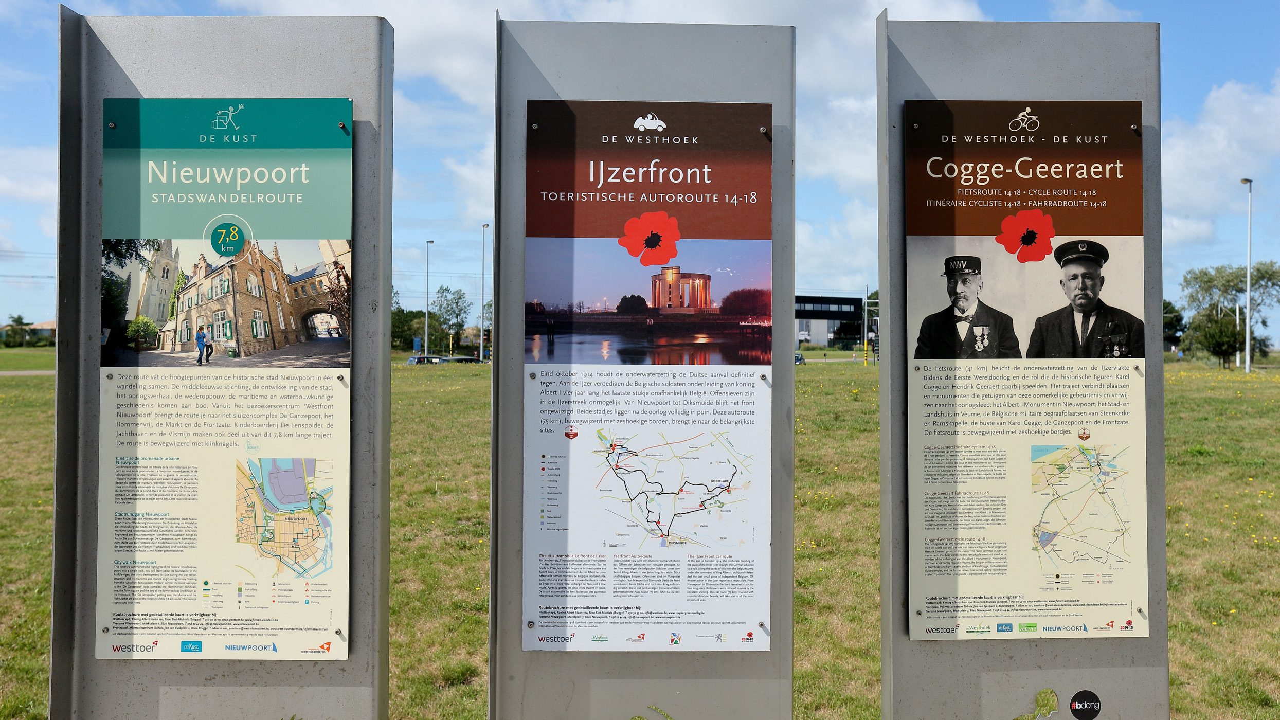
Tip 1: Er is de fietsroute Cogge-Geeraert van zo’n 41 km lang die de onderwaterzetting van de IJzervlakte belicht. Er is ook een autoroute “Ijzerfront” van 75 km lang.

Tip 2: Wil je de spoorwegbedding die als dijk diende gaan bekijken, begeef je dan naar de gereconstrueerde Belgische Stelling aan de Frontzate.
Geografische informatie
Adres: Handelskaai 21, 8620 Nieuwpoort, West-Vlaanderen, Vlaanderen, België
Geografische coördinaten:
– Google Maps: Latitude = 51.1356077 – Longitude = 2.7440369
– Open Street Maps: Latitude = 51.135541 – Longitude = 2.744162
– Altitude h = 1 m
Aanduiding van Kattesas - Onderwaterzetting IJzervlakte op:
Toeristische kaart van Top.Vlaanderen – Google Maps – OpenStreetMap.
Route naar Kattesas - Onderwaterzetting IJzervlakte: Route via Google Maps
Meteo

| Day | Condition | Temperature | Precipitation | Rain Chance | Wind | Humidity | Pressure |
|---|---|---|---|---|---|---|---|
|
Today
21:00
|
|
18° | 20°°C | 1 mm | 100% | 17 Km/h | 91 % | 1018 mb |
|
Tomorrow
21:00
|
|
18° | 22°°C | 1 mm | 100% | 30 Km/h | 93 % | 1022 mb |
|
zo jun 26
21:00
|
|
16° | 19°°C | 0 mm | 0% | 21 Km/h | 72 % | 1026 mb |
|
ma jun 26
21:00
|
|
16° | 19°°C | 0 mm | 0% | 19 Km/h | 72 % | 1025 mb |
|
di jun 26
21:00
|
|
16° | 19°°C | 0 mm | 0% | 16 Km/h | 70 % | 1024 mb |
| Hour | Condition | Temperature | Precipitation | Rain Chance | Wind | Humidity | Pressure |
|---|---|---|---|---|---|---|---|
|
Today
06:00
|
|
19° | 22°°C | 0.08 mm | 8% | 12 Km/h | 91 % | 1017 mb |
|
Today
09:00
|
|
20° | 21°°C | 0.82 mm | 82% | 6 Km/h | 89 % | 1018 mb |
|
Today
12:00
|
|
21° | 21°°C | 1 mm | 100% | 8 Km/h | 84 % | 1018 mb |
|
Today
15:00
|
|
22° | 22°°C | 0.2 mm | 20% | 17 Km/h | 80 % | 1016 mb |
|
Today
18:00
|
|
21° | 21°°C | 0.2 mm | 20% | 17 Km/h | 81 % | 1015 mb |
|
Today
21:00
|
|
20° | 20°°C | 1 mm | 100% | 7 Km/h | 91 % | 1016 mb |
|
Tomorrow
00:00
|
|
19° | 19°°C | 1 mm | 100% | 10 Km/h | 89 % | 1016 mb |
|
Tomorrow
03:00
|
|
19° | 19°°C | 0 mm | 0% | 20 Km/h | 93 % | 1016 mb |
Getijdenvoorspellingen
Wil U de getijden zien voor een andere datum?
Internet informatie over Kattesas - Onderwaterzetting IJzervlakte
Wikipedia informatie over:
– de Inundatie van de IJzervlakte (NL)
– Inundatie (NL – EN – DE)
– de waterloop IJzer (NL – FR – EN)
– de Slag om de IJzer (NL – FR – EN)
– de held Karel Cogge (NL – FR)
Dienst voor Toerisme Nieuwpoort “Visit Nieuwpoort”:
website – Facebook – Instagram
Toerisme “De Kust” (Westtoer)
Website – Facebook – Instagram – ![]() YouTube
YouTube
Onze foto’s over Kattesas - Onderwaterzetting IJzervlakte
Onze foto’s, video’s, … zijn allen (c) 2004-2026, Top.Vlaanderen, België. Ze mogen niet “zomaar” worden overgenomen of gebruikt. Wil je ze gebruiken voor een of ander project, contacteer ons vooraf en we kijken hoe we kunnen samenwerken. Wil U uw eigen toeristische attractie, B&B, vakantiewoning… laten fotograferen door ons, dat kan ook. Neem hiervoor contact met ons op via ons Contactformulier .
Foto’s van het Kattesas (3 februari 2026)
Klik op een van de onderstaande foto’s om de fotocarrousel op te starten…


Foto’s van de Overlaat van de Noordvaart / Veurne-Ambacht (3/4 februari 2026)
Deze overlaat ligt aan het sluizencomplex “Ganzenpoot“, vlak naast de Veurnesluis. Hier kon men dus eind oktober 1914 met een voldoende debiet water opstuwen in de richting van de IJzervlakte.
Klik op een van de onderstaande foto’s om de fotocarrousel op te starten…


Foto’s van Karel Cogge’s standbeeld te Veurne (2 februari 2026)
Klik op een van de onderstaande foto’s om de fotocarrousel op te starten…


Disclaimer: Alle informatie die op top.vlaanderen wordt gepresenteerd werd met de grootste zorg samengesteld. Ze wordt ook regelmatig nagezien. Indien U opmerkingen heeft, fouten ziet, aanvullende informatie hebt, enzovoort… contacteer ons dan via ons contactformulier. Wij zijn niet verantwoordelijk voor mogelijks foutieve of onvolledige informatie.